
How Do I Choose an East Coast Small Town to Relocate To?
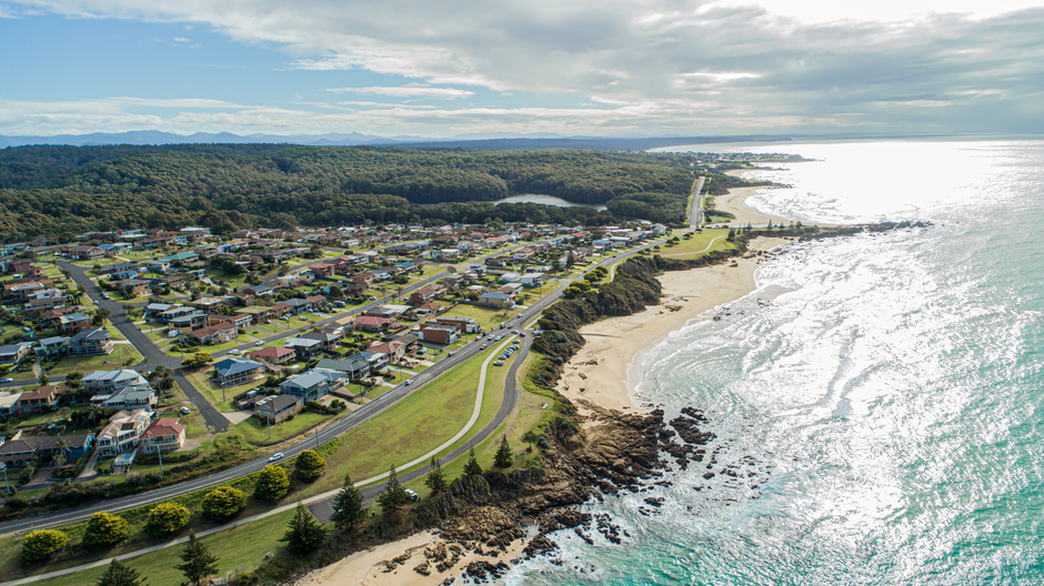
Choose an East Coast small town with a weighted scorecard, not a postcard test: compare housing costs and taxes, hazard exposure, local jobs, hospital quality, internet access, and off-season services before choosing a finalist. Public data can narrow the field, but no national source can declare one town “best” because affordability, coastal risk, and daily-life needs vary by household.
The operating rule is simple: score the places against the life you will actually run there. A beach view is not a plan for a delayed medical appointment, a thin job market, or an insurance bill that changes the housing budget. Build the comparison first. Fall in love second.
What are the best affordable small towns on the East Coast to live in?
There is no defensible universal list of the best affordable towns from the available public data; the best candidate is the town that clears your household’s cost, work, care, and risk thresholds at the same time. Use the U.S. Census Bureau’s American Community Survey subject tables to compare local housing financial characteristics, real-estate taxes, commuting, and internet subscriptions on one consistent basis.
Run a six-column scorecard. Give each town the same weight before reading local listings. That protects the decision from the common failure mode: treating a low listing price as a low cost of living.
| Scorecard column | What to compare | Public-data starting point |
|---|---|---|
| Housing | Housing costs, mortgage costs, and real-estate taxes | ACS table S2503 |
| Work | Employment base, industry mix, and average weekly wages | BLS QCEW county data |
| Mobility | Commuting patterns and means of transportation to work | ACS tables S0801 and S0802 |
| Connectivity | Household computer and internet subscriptions | ACS tables S2801 and S2802 |
| Care | Quality information for nearby eligible hospitals | CMS Care Compare |
| Risk | Hazard and community-risk context | FEMA National Risk Index |
Weak question: “Is this town cheap?” Stronger question: “After taxes, insurance, transport, and the services this household uses, does this town still fit?” The second question creates a decision you can audit.
For families, add school and childcare research from local and state sources before placing a town on the shortlist; the supplied datasets do not rate those services. For retirees, place hospital access and the practical distance to routine care near the top. For remote workers, make internet availability a gate, not a bonus. Town-level subscription data describes local patterns, not the connection at a particular address.
Which East Coast small towns are walkable without being tourist-only towns?
A walkable, year-round town is one where errands, services, and social life still function after visitors leave, and public national data can identify useful proxies rather than certify that outcome. ACS commuting tables show how residents get to work, while an off-season visit or local-record review shows whether the sidewalks lead to open grocery stores, clinics, libraries, and daily services.
Do not confuse a compact historic core with a functional car-light life. A visitor can walk between shops for an afternoon. A resident needs to reach the pharmacy, food, appointments, and routine activities in bad weather and outside peak season.
- Check the commute pattern. Compare ACS tables S0801 and S0802 across candidates. A larger share of walking, transit, or short local trips can be a useful signal, but it is not proof that every neighborhood is walkable.
- Check the service map. List the places your household uses in an ordinary week and map them from the likely neighborhood. Do this for the quiet months, not only a festival weekend.
- Check the workday. The Bureau of Labor Statistics Quarterly Census of Employment and Wages covers more than 95 percent of U.S. jobs reported by employers and can show the county employment base and industry concentration. That matters when remote work changes or a second household income is needed.
Tourism pressure is a local fact pattern, not a national label. Search municipal meeting records, planning documents, and local forums for discussions of seasonal staffing, short-term rentals, parking, and service hours. Read the disagreement, not just the brochure. It tells you where the daily friction lives.
How can I compare property taxes and homeowners insurance before moving?
Compare property taxes and insurance by separating a town-level cost screen from an address-level quote: ACS can support the first task, while the tax assessor, insurer, and flood-map review handle the second. Treat any advertised monthly payment without those pieces as incomplete.
Use ACS table S2503 to compare housing financial characteristics and real-estate taxes across small geographies. Then open the relevant local tax assessor’s records and confirm how a property is assessed, what exemptions may apply, and which local charges appear on the bill. Those local rules are not supplied in the national sources, so public data does not replace an assessor review.
Insurance deserves the same discipline. FEMA states on its Flood Map Service Center that most homeowners insurance does not cover flood damage. Search the exact address, review effective and preliminary map products, and request insurance information for the specific structure rather than assuming a town’s reputation answers the question.
Bad comparison: “The homes cost less near the water.” Useful comparison: “The purchase price, property tax record, homeowners quote, flood exposure, and flood-insurance question all clear the budget.” That is the full-cost line: every recurring cost visible before the decision, not discovered after it.
Use FEMA’s December 2025 National Risk Index as the wider screen. Its version 1.20 dataset provides baseline measures for every U.S. county and Census tract and covers 18 hazards, including coastal flooding, hurricane, inland flooding, strong wind, heat wave, and winter weather. FEMA describes it as a tool that helps illustrate communities most at risk; it is not a substitute for property-level maps and quotes.
What is a small coastal town like after summer visitors leave?
After summer visitors leave, a small coastal town may become quieter, less convenient, and more revealing; the right research question is whether essential services, work access, care, and transportation still match your normal week. No source in this dossier ranks off-season livability, so verify it through local schedules, public records, and an off-season stay when feasible.
Use a Tuesday test. Pick an ordinary weekday outside peak season and check the operating hours of groceries, pharmacies, clinics, town offices, restaurants, and any service your household relies on. Review local government agendas for roadwork, seasonal staffing, housing, and resilience discussions. This replaces vague “small-town charm” with observable operating conditions.
Coastal scenery also needs a risk briefing. NOAA’s Sea Level Rise and Coastal Flooding Impacts Viewer maps potential inundation, relative depth, high-tide flooding susceptibility, historical flood-event counts, and mapping confidence at local coastal locations. NOAA reports that annual tidal-flood occurrences have increased five- to tenfold since the 1960s in several U.S. coastal cities. The viewer is planning context, not a property-level legal or permitting determination, because it does not account for factors such as erosion, subsidence, future construction, or wind-driven tides.
For resilience planning, a household may also review practical backup-power needs; this guide on what size solar generator is needed for essential appliances can help frame the equipment question. It does not replace local hazard, building, or insurance due diligence.
Make the final decision with the completed scorecard, a verified address-level risk review, and a realistic week of errands. The goal is not a perfect town. It is a town whose tradeoffs are visible, acceptable, and affordable before the moving truck arrives.
Frequently Asked Questions
Which towns have access to hospitals, airports, and reliable internet?
No single federal dataset combines hospitals, airports, and internet into a town ranking. Use Census ACS internet-subscription tables for local connectivity, CMS Care Compare for nearby hospital quality, and a mapping review of airport travel time. Check each address with an internet provider before signing a lease or purchase agreement, because town-level data cannot confirm service at one home.
How do I check flood, hurricane, and sea-level-rise risk for a town?
Start with FEMA's December 2025 National Risk Index to compare county or Census-tract exposure across 18 hazards. Then search the prospective address in FEMA's Flood Map Service Center and review NOAA's Sea Level Rise and Coastal Flooding Impacts Viewer for coastal context. These tools screen risk; insurance quotes and local records remain necessary for a specific property.
Should I rent for a year before buying in an East Coast small town?
A rental period can reveal off-season services, commute patterns, weather disruption, and tourism pressure that a short visit cannot show. The right choice depends on available rentals, household timing, and local housing conditions, which the provided public sources do not measure. Treat the rental period as a due-diligence window: compare bills, service access, and the practical travel time to the places used every week.
Sources
- U.S. Census Bureau American Community Survey Subject Tables
- U.S. Bureau of Labor Statistics Quarterly Census of Employment and Wages
- Federal Emergency Management Agency National Risk Index
- FEMA Flood Map Service Center
- NOAA Sea Level Rise and Coastal Flooding Impacts Viewer
- Centers for Medicare & Medicaid Services Hospital Quality Initiative
Disclaimer: This article is for general information only and is not financial advice. It does not take your personal circumstances into account, and past performance does not predict future results. Speak to a licensed financial professional before making money decisions.